Nations Online
All Countries in the World
Nations Online All Countries in the World | |
| Home |
___ Administrative Map of Poland |
Map is showing Poland and the surrounding countries with international borders, province boundaries, province capitals, and the national capital Warsaw. Primary Administrative Regions of PolandPoland is divided into 16 voivodeships (provinces).The provinces in their English :: Polish names are (capital cities in parenthesis): | ||
| Greater Poland :: Wielkopolskie (Poznań) Kuyavian-Pomeranian :: Kujawsko-Pomorskie (Bydgoszcz and Toruń) Lesser Poland :: Małopolskie (Kraków) Lódź :: Łódzkie (Łódź) Lower Silesian :: Dolnośląskie Wrocław Lublin :: Lubelskie (Lublin) Lubusz :: Lubuskie (Gorzów Wielkopolski and Zielona Góra) Masovian :: Mazowieckie (Warsaw) Opole :: Opolskie (Opole) | Podlaskie :: Podlaskie (Białystok) Pomeranian :: Pomorskie (Gdańsk) Silesian :: Śląskie (Katowice) Subcarpathian :: Podkarpackie (Rzeszów) Świętokrzyskie (Holy Cross) :: Świętokrzyskie (Kielce) Warmian-Masurian :: Warmińsko-Mazurskie (Olsztyn) West Pomeranian :: Zachodniopomorskie (Szczecin). | |
Click on the map for a Political Map of Poland. 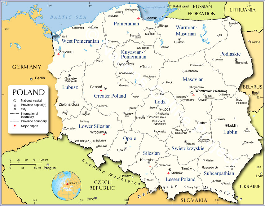 Administrative Map of Poland |
||
One World - Nations Online .:. let's care for this planet Promote that every nation assumes responsibility for our world. Nations Online Project is made to improve cross-cultural understanding and global awareness. More signal - less NOISE |
| Site Map
| Information Sources | Disclaimer | Copyright © 1998-2024:: nationsonline.org |