Nations Online
All Countries in the World
Nations Online All Countries in the World | |
Home  |
___ Satellite View and Map of São Tomé and Príncipe |
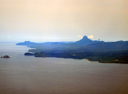
About São Tomé and PríncipeSatellite view is showing the Western African islands straddling the equator in the Gulf of Guinea. The island nation consists of two main islands and several smaller ones.The island of São Tomé is located about 320 km (200 mi) west of Gabon, Principe island lies west of Equatorial Guinea. Capital city of São Tomé and Príncipe is São Tomé, just zoom in to see the city. Spoken languages are Portuguese (official) and Portuguese Creole. São Tomé and Príncipe is geographically relative close to the West African countries of Cameroon, Equatorial Guinea, Gabon, and Nigeria. The map shows São Tomé and Príncipe with expressways, main roads and streets, São Tomé International Airport (IATA code: TMS) is located about 5 mi (8 km) northwest of São Tomé. To find a location use the form below. To view just the map, click on the "Map" button. |
|
| To find a location type: street or place, city, optional: state, country. |
Local Time São Tomé and Príncipe:
Tuesday-July-21 21:05
No UTC/GMT offset |
|
φ Latitude, λ Longitude (of Map center; move the map to see coordinates): , |
||||||
| Google Maps: Searchable map/satellite view of the Democratic Republic of Sao Tome and Principe. |
Bookmark/share this page |
|||||
| More about São Tomé and Príncipe: Cities: Country: Continent: |
Weather Conditions São Tomé
|
Related Consumer Information:
|
||||
Countries and Territories of Africa |
||||||
Map Help [ show ] |
||||||
One World - Nations Online .:. let's care for this planet Promote that every nation assumes responsibility for our world. Nations Online Project is made to improve cross-cultural understanding and global awareness. More signal - less NOISE |
| Site Map
| Information Sources | Disclaimer | Copyright © 1998-2024:: nationsonline.org |