Nations Online
All Countries in the World
|
One Planet Nations Online All Countries in the World | |
| Home |
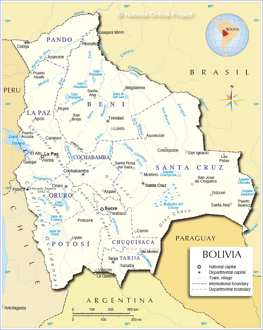
___ Administrative Map of Bolivia |
| Map is showing Bolivia and its administrative regions with departmental boundaries and the department capitals. Bolivia is divided into nine administrative regions called departments (departamentos) Departments of Bolivia (capital names in parentheses): Beni (Trinidad), Chuquisaca (Sucre, is also Bolivia's legal capital and seat of the judiciary), Cochabamba (Cochabamba), La Paz (La Paz, is Bolivia's administrative capital), Oruro (Oruro), Pando (Cobija), Potosí (Potosí), Santa Cruz (Santa Cruz de la Sierra; most populated city in Bolivia) and Tarija (Tarija) Click on the image below to view a large detailed map of Bolivia.  Administrative Map of Bolivia |
||||||
| More about Bolivia Cities: Country: Key statistic figures Bolivia. Continent: |
La Paz Current Weather Conditions |
Related Consumer Information: |
||||
One World - Nations Online .:. let's care for this planet Promote that every nation assumes responsibility for our world. Nations Online Project is made to improve cross-cultural understanding and global awareness. More signal - less NOISE |
| Site Map
| Information Sources | Disclaimer | Copyright © 1998-2023 :: nationsonline.org |