
|
|
___ Administrative Map of Guinea |
|
Guinea is divided into 4 geographical regions and 8 administrative regions, where the national capital Conakry ranks as a special zone. The other 7 regions are further subdivided into 33 prefectures. The four geographical regions, they have a with distinct human, geographic, and climatic characteristics: Maritime Guinea (La Guinée Maritime), Mid-Guinea (La Moyenne-Guinée), Upper-Guinea (La Haute-Guinée), and Forested Guinea (Guinée forestière), a forested and mountainous region. The eight administrative regions are, they are named after their capitals: Boké Region, Conakry Region, Faranah Region, Kankan Region, Kindia Region, Labé Region, Mamou Region, and Nzérékoré Region Guinea is a country on the west coast of Africa. The map is showing Guinea and the surrounding countries with international borders, province boundaries, the national capital Conakry, and the province capitals. Border Countries: Côte d'Ivoire, Guinea-Bissau, Liberia, Mali, Senegal, Sierra Leone. |
 Bookmark/share this page |
 One World - Nations Online All Countries of the World |
|
|
||
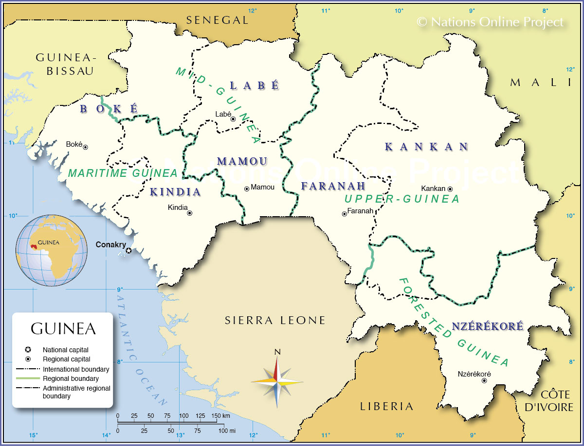 Administrative Map of Guinea Map based on a UN map. Source: UN Cartographic Section | |||||||
| More about Guinea Cities: Country: Continent: |
Major Cities and Towns in Guinea The largest cities are: Conakry, Nzérékoré, Kindia, Boké, Kankan, Kissidougou, Guékédou, Kamsar, Mamou, and Macenta. |
Conakry Current Weather Conditions
|
Related Consumer Information:
|
||||
Political Maps of other Countries in West Africa: Benin Map | Burkina Faso Map | Cape Verde Map | Côte d'Ivoire Map | Ghana Map | Guinea-Bissau Map Liberia Map | Mali Map | Mauritania Map | Niger Map | Nigeria Map | Senegal Map | Sierra Leone Map | Togo Map |
|||||||
One World - Nations Online .:. let's care for this planet Every nation is responsible for the current state of our world. |
| Site Map
| Information Sources | Disclaimer: Privacy Policy, etc. Contact: [email protected] | Copyright © 1998-2021 :: nationsonline.org |
