Nations Online
All Countries in the World
|
One Planet Nations Online All Countries in the World | |
Home  |
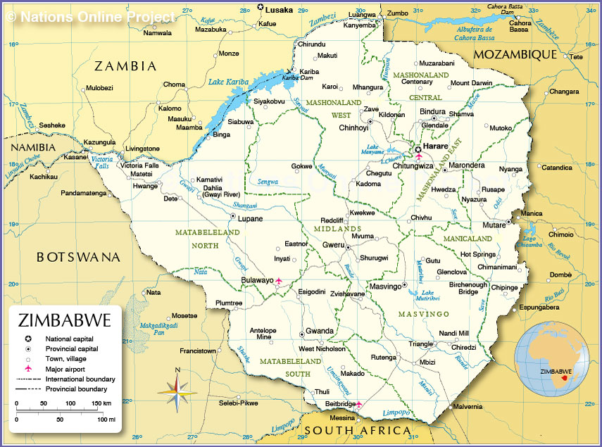
___ Administrative Map of Zimbabwe |
Zimbabwe is divided into 8 provinces and 2 cities with provincial status: (province capitals in parentheses) Bulawayo, the second largest city in Zim has procincial status, same as the capital Harare. Manicaland (Mutare), Mashonaland Central (Bindura), Mashonaland East (Marondera), Mashonaland West (Chinhoyi), Masvingo Province, (Masvingo), Matabeleland North (Lupane), Matabeleland South (Gwanda), and Midlands Province (Gweru)  Administrative Map of Zimbabwe |
One World - Nations Online .:. let's care for this planet Made to improve cross-cultural understanding, global awareness, and cultivating a cosmopolitan consciousness. |
 |
|
| Site Map
| Information Sources | Disclaimer: Privacy Policy, etc. | Contact:
[email protected]
Copyright © 1998-2017 :: nationsonline.org | ||