Nations Online
All Countries in the World
Nations Online All Countries in the World | |
| Home |
___ Administrative Map of Zambia |
| Map is showing Zambia with surrounding countries, states borders, the national capital, provinces borders, and province capitals (in bold). Click for a Political Map of Zambia. 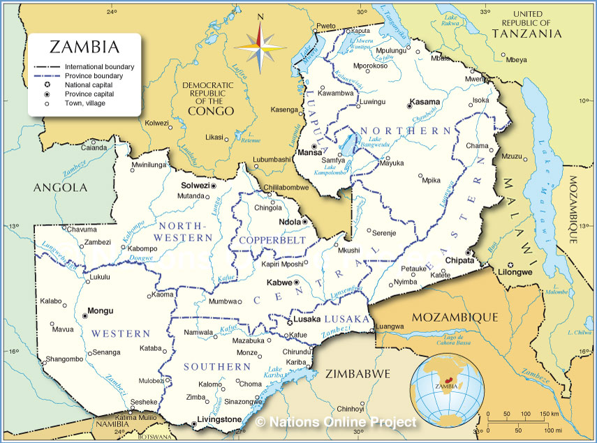 Administrative Map of Zambia |
| Administrative Regions of Zambia Zambia is divided into nine provinces The provinces are (province capital in parenthesis) Central (Kabwe), Copperbelt (Ndola), Eastern (Chipata), Luapula (Mansa), Lusaka (Lusaka), North-Western (Solwezi), Northern (Kasama), Southern (Livingstone), and Western (Mongu). |
One World - Nations Online .:. let's care for this planet Promote that every nation assumes responsibility for our world. Nations Online Project is made to improve cross-cultural understanding and global awareness. More signal - less NOISE |
| Site Map
| Information Sources | Disclaimer | Copyright © 1998-2024:: nationsonline.org |