Nations Online
All Countries in the World
|
One Planet Nations Online All Countries in the World | |
Home  |
___ Satellite View and Map of Panama City (Ciudad de Panamá) |
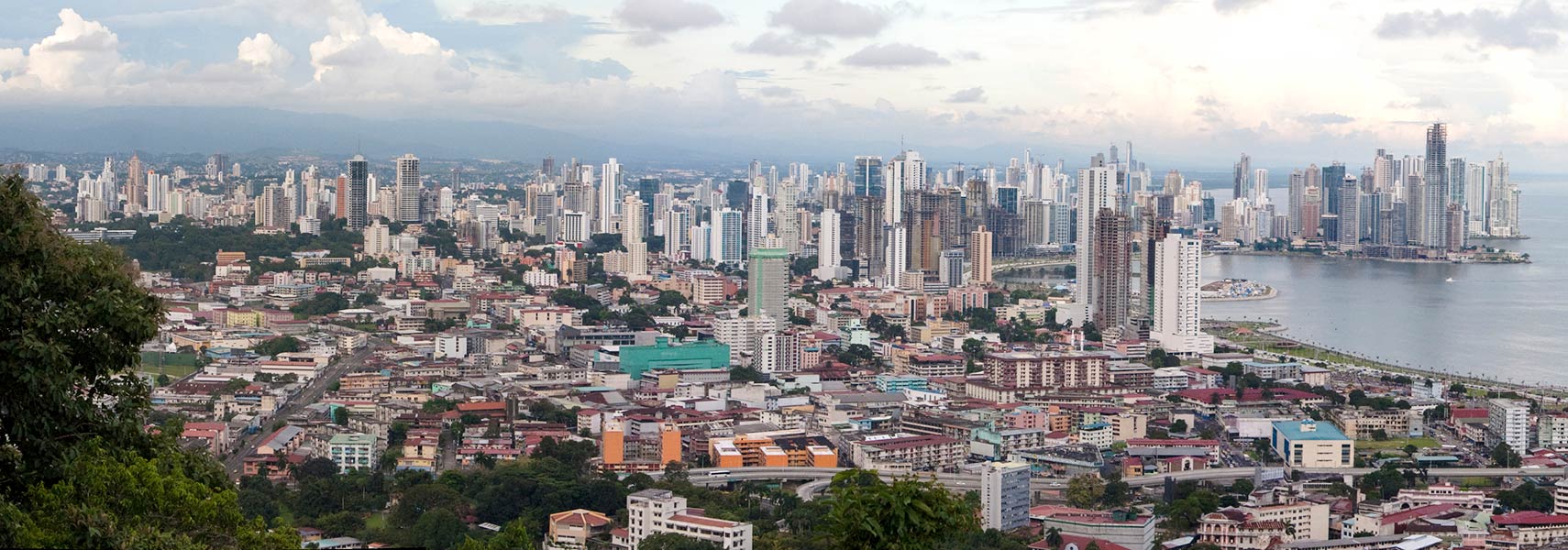
 Panorama of Panama City seen from Ancon Hill. Image: Brian Gratwicke |
About Panama City Satellite view is showing Panama City, the national capital of Satellite view is showing Panama City, the national capital of The city was founded in 1519 by the Spanish. Within a few years the city became a launching point for expeditions of the Spanish conquistadores that conquered the Inca Empire in Peru, and a transit point for gold and silver headed back to Spain. In 1671 the city was destroyed by a fire when Welsh privateer Henry Morgan wreaked havoc and sacked the settlement. Panama was rebuilt two years later on a peninsula located 5 km (3 miles) to the south west from the original town. It is today the historic district of Panama City known as Casco Viejo. Panama's old quarter features many architectural styles, from Spanish colonial buildings to French and Antillean townhouses. The site of the devastated town is still in ruins and is now a popular tourist attraction known as Panama Viejo (Old Panama). Today Panama City has a city population of about 880,000 inhabitants and a total of 1.5 million people live in the city's metropolitan area, it is the political, administrative and cultural center of the country. Official language is Spanish. The map shows a city map of Panama City with expressways, main roads and streets, and the location of Tocumen International Airport (IATA code: PTY), the largest and busiest airport in Central America is 20.3 km (12.6 mi) by road (via Corredor Sur) away from Panama City. To find a location use the form below. |
|
| To find a location type: street or place, city, optional: state, country. |
Local Time Panama:
Wednsday-April-17 2024 14:46
Standard Time Zone: Eastern (EST), UTC/GMT -5 hours |
|
φ Latitude, λ Longitude (of Map center; move the map to see coordinates): , |
||||||
| Google Maps: Searchable map/satellite view of Panama City City Coordinates: 8°59′N 79°31′W |
Bookmark/share this page
|
|||||
| More about Panama: Landmarks: Country: Continent: | Weather Conditions Panama City External Links: Panama City (official website) Wikipedia: Panama City |
Related Consumer Information:
|
||||
| Searchable Maps of other Capital Cities in Central America: Belmopan, Guatemala City, Managua, San José, San Salvador, Tegucigalpa Searchable Maps of Countries of Central America: Belize, Costa Rica, El Salvador, Guatemala, Honduras, Nicaragua, Panama |
||||||
Map Help [ show ]  |
||||||
One World - Nations Online .:. let's care for this planet Promote that every nation assumes responsibility for our world. Nations Online Project is made to improve cross-cultural understanding and global awareness. More signal - less NOISE |
| Site Map
| Information Sources | Disclaimer | Copyright © 1998-2023 :: nationsonline.org |