Nations Online
All Countries in the World
Nations Online All Countries in the World | |
Home  |
___ Satellite View of the City of Port Vila, Vanuatu |
About Port Vila Satellite view is showing Port Vila, largest city and the national capital of Satellite view is showing Port Vila, largest city and the national capital of 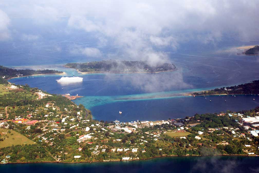 Aerial view of central Port Vila with Iririki island and Ifira island in background. Image: Phillip Capper Official languages are Bislama, English, and French. The town is seat of the Vanuatu Parliament and one site of the University of the South Pacific. Port Vila is the hub of tourism in Vanuatu. About 60,000 tourists annually visit the islands by air transport and cruise ships. It is also a popular destination for the yachting community. The Map shows a city map of Port Vila with main roads and streets, Vanuatu's Bauerfield International Airport (IATA Code: VLI) in north. To find a location use the form below. |
| To find a location type: street or place, city, optional: state, country. |
|
φ Latitude, λ Longitude (of Map center; move the map to see coordinates): , |
||||||
| Google Earth: Searchable map and satellite view of Port Vila, Vanuatu. City Coordinates: 17°45′S 168°18′E |
Bookmark/share this page |
|||||
| More about Vanuatu: External Links: Wikipedia: Port Vila Wikipedia article about Port Vila. |
Weather Conditions Port Vila:
|
Related Consumer Information:
|
||||
Other Melanesian Island Nations and Territories: Fiji, New Caledonia, Papua New Guinea, Solomon Islands |
||||||
Map Help [ show ] |
||||||
One World - Nations Online .:. let's care for this planet Promote that every nation assumes responsibility for our world. Nations Online Project is made to improve cross-cultural understanding and global awareness. More signal - less NOISE |
| Site Map
| Information Sources | Disclaimer | Copyright © 1998-2023 :: nationsonline.org |

