
| Home |
|
|
|
___ Administrative Map of Vanuatu |
|
About VanuatuVanuatu is an island nation in the South Pacific Ocean, northeast of New Caledonia, east of Australia and west of Fiji.The archipelago has a population of 278,000 (in 2015), capital and largest city is Port Vila. Map is showing the Vanuatu archipelago with provincial boundaries, the national capital Port Vila on the island of Efate, provincial capitals, major cities, and main roads. Since 1994, Vanuatu has been divided into the six provinces. The provinces are Malampa (capital: Lakatoro), Penama (capital: Saratamata), Sanma (capital: Luganville), Shefa (capital: Port Vila), Tafea (capital: Isangel), and Torba (capital: Sola). The main Islands within these provinces include: Banks and Torres (Torba), Espiritu Santo (Sanma), Maewo and Pentecost (Penama), Malekula and Ambrym (Malampa), Epi and Efate (Shefa), Erromango, Tanna and Aneityum (Tafea) Other Melanesian nations and territories: Fiji, New Caledonia, Papua New Guinea, Solomon Islands |
 Bookmark/share this page |
 One World - Nations Online all countries of the world |
|
|
||
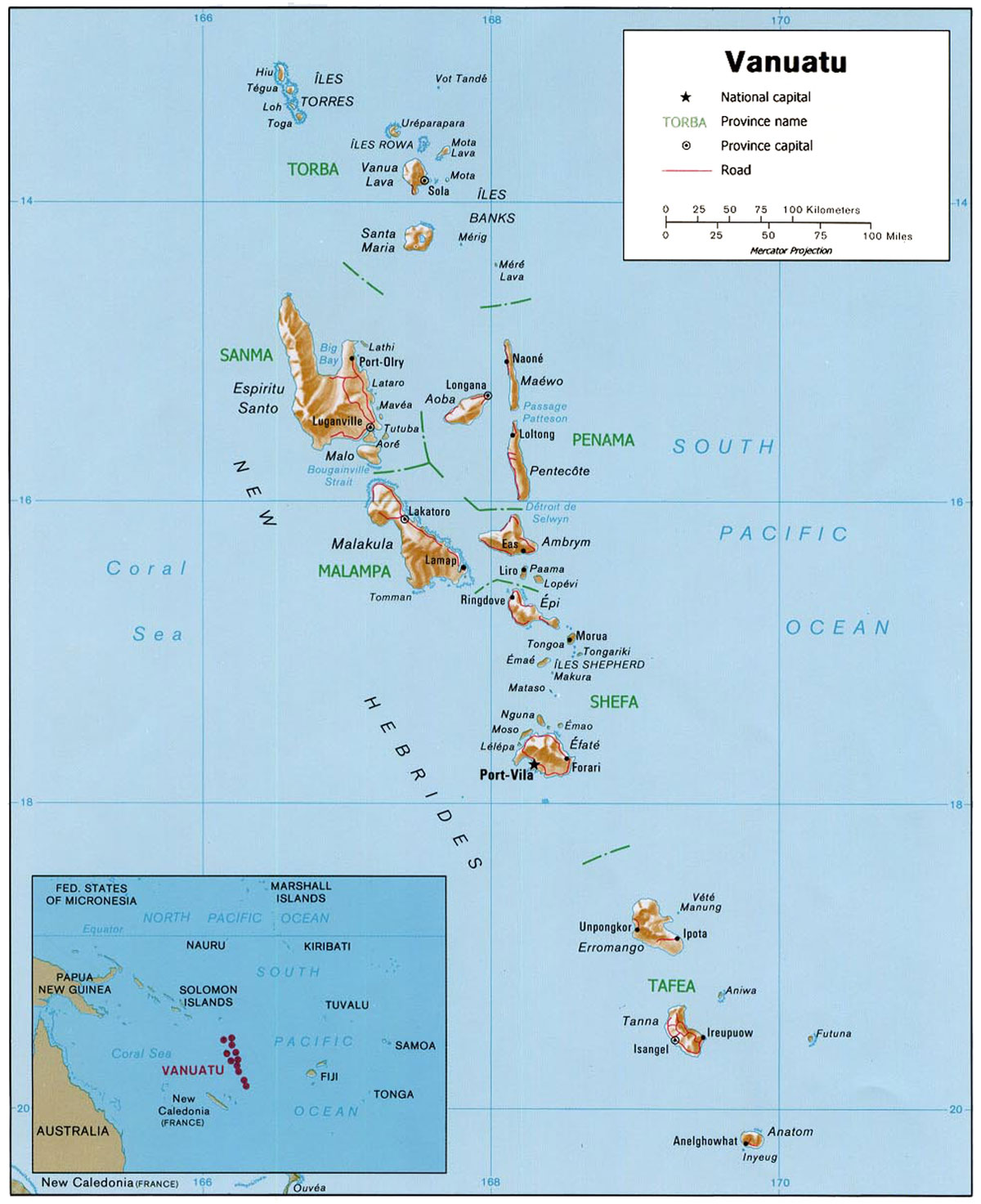 Map of the Republic of Vanuatu |
| More about Vanuatu: Cities: Country: Continent: |
Explore more:
|
Weather Conditions Port Vila:
|
Related Consumer Information:
|
||||
One World - Nations Online .:. let's care for this planet Every nation is responsible for the current state of our world. |
| Site Map
| Information Sources | Disclaimer: Privacy Policy, etc. Contact: [email protected] | Copyright © 1998-2021 :: nationsonline.org |
