
| Home |
|
___ Administrative Map of Paraguay |
Map is showing Paraguay and the surrounding countries with international borders, department boundaries, the national capital Asunciòn, provincial capitals, major cities, and towns. Border Countries: Argentina, Bolivia, and Brazil |
 One World - Nations Online all countries of the world |
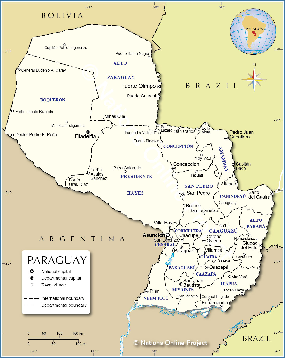 Administrative Map of Paraguay Map based on a UN map. Source: UN Cartographic Section |
|||||||
Administrative Divisions of ParaguayParaguay consists of seventeen departments (departamento) and one capital district (distrito capital) which is Asunciòn.Departments of Paraguay from north to south (capital in parentheses): Alto Paraguay(Fuerte Olimpo), Boquerón (Filadelfia), Concepción (Concepción), Amambay (Pedro Juan Caballero), Presidente Hayes (Villa Hayes), San Pedro (San Pedro), Canindeyú (Salto del Guairá), Alto Paraná (Ciudad del Este), Caaguazú (Coronel Oviedo), Cordillera (Caacupé), Central (Areguá), Paraguarí (Paraguarí), Guairá (Villarrica), Caazapá (Caazapá), Ñeembucú (Pilar), Misiones (San Juan Bautista), Itapúa (Encarnación) |
More about Paraguay Cities: Country: Continent: |
Current Weather Conditions Asunción:
|
Related Consumer Information: |
||||
One World - Nations Online .:. let's care for this planet Every nation is responsible for the current state of our world. |
| Site Map
| Information Sources | Disclaimer: Privacy Policy, etc. Contact: [email protected] | Copyright © 1998-2021 :: nationsonline.org |
