
| Home |
|
|
|
___ Physical Map of Antarctica |
|
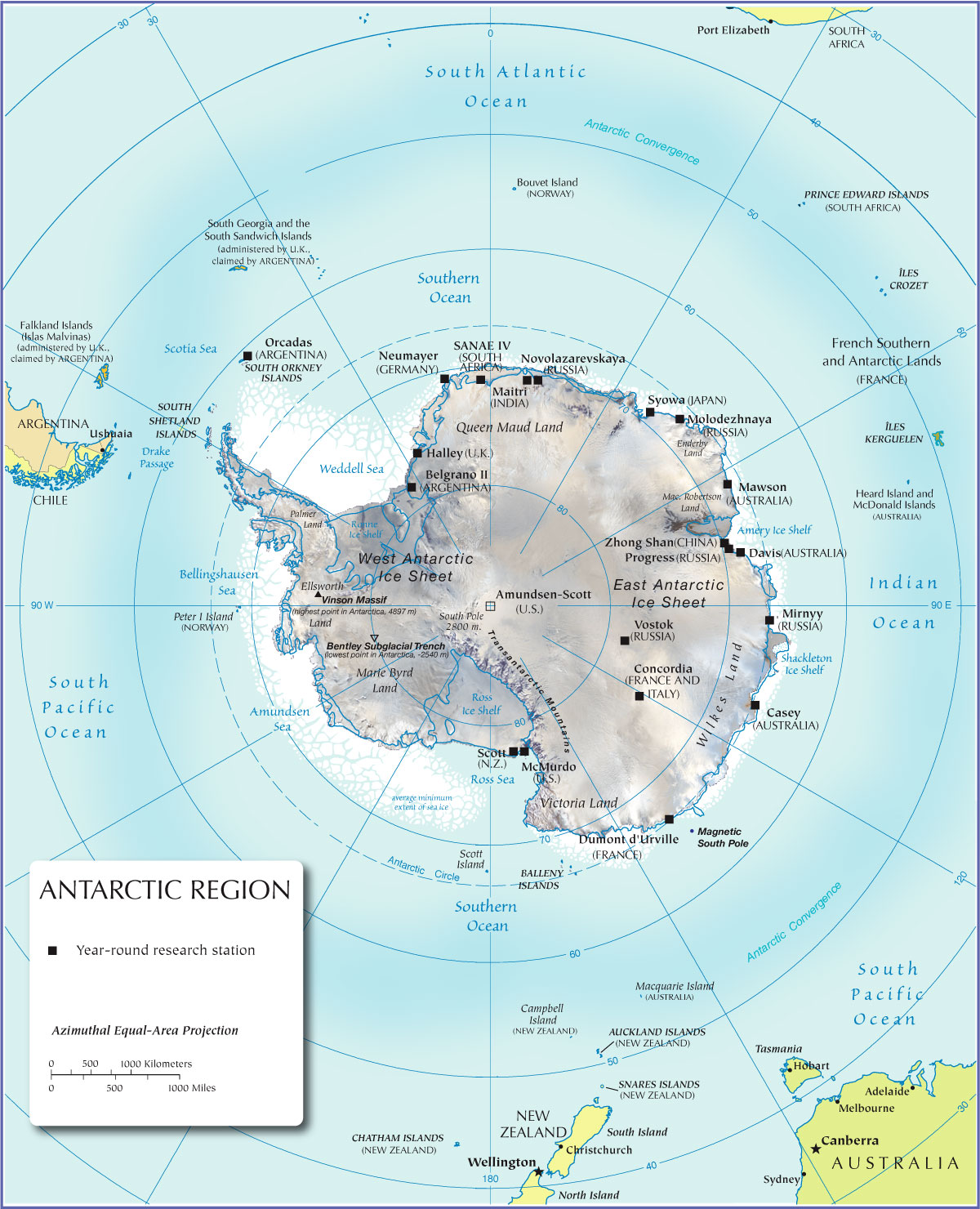
| About Antarctica Map is showing the Antarctic circle and the continent of Antarctica with a land area of 14 million km² (280,000 km² ice-free, 13.72 million km² ice-covered), so Antarctica is almost twice the size of Australia (7,617,930 km²), it is the world's fifth-largest continent in area, after Asia, Africa, North America, and South America (see the Americas). Not quite in the center of Antarctica is the South Pole, by convention it is the southernmost point on the surface of the Earth (wherever you would go from here you would go north, somehow). The South Pole is also one of the endpoints of Earth's rotation axis. The South Pole is not really a fixed point, simply because Earth is rotating slightly off-center, our planet 'wobbles' a tiny little bit, scientists call this behavior the Polar motion, it is the movement of Earth's rotational axis across its 'surface', and - the deflection is just a few meters. The nearest countries to Antarctica are South Africa, Australia, New Zealand, Chile and Argentina. On Antarctica there are no cities or villages, 98% of the continent is covered by ice. The map shows also the location of scientific research stations operated by various countries on the continent. |
 Bookmark/share this page |
 One World - Nations Online All Countries of the World |
|
|
||
 Physical Map of Antarctica |
|||||||
| More about Antarctica |
Related Topics: Map is showing the world's continents and regions. World map showing independent states borders, dependencies or areas of special sovereignty, islands and island groups as well as capital cities. Shaded relief map of the world, showing landmasses, continents, oceans, regions, mountain ranges, islands and island groups as well as extreme points. |
Current Weather Conditions South Pole:
|
Related Consumer Information:
|
||||
One World - Nations Online .:. let's care for this planet Every nation is responsible for the current state of our world. |
| Site Map
| Information Sources | Disclaimer: Privacy Policy, etc. Contact: [email protected] | Copyright © 1998-2021 :: nationsonline.org |
