Nations Online
All Countries in the World
Nations Online All Countries in the World | |
| Home Map Index  |
___ Administrative Map of Malawi |
| Map is showing Malawi, a landlocked country in southern central Africa in the Great Rift Valley, on the western shore of Lake Nyasa. The map shows the country with international borders, provincial boundaries, the national capital Lilongwe, regional capitals, district capitals, cities and towns, and major airports. Click on the map to see a detailed map of Malawi. 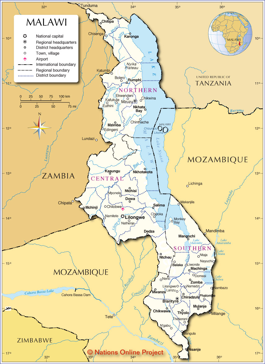 Administrative Map of Malawi Malawi is divided into three regions and subdivided into 28 districts. Malawi Regions (province capitals in parenthesis): The Northern Region (Mzuzu), the Central Region (Lilongwe), and the Southern Region (Blantyre). Malawi's 28 districts are named after their capitals: Northern Region: Chitipa, Karonga, Likoma, Mzimba, Nkhata Bay, Rumphi Central Region: Dedza, Dowa, Kasungu, Lilongwe, Mchinji, Nkhotakota, Ntcheu, Ntchisi, Salima. Southern Region: Balaka, Blantyre, Chikwawa, Chiradzulu, Machinga, Mangochi, Mulanje, Mwanza, Nsanje, Thyolo, Phalombe, Zomba, Neno See a list of Malawi's cities and towns in Political Map of Malawi |
One World - Nations Online .:. let's care for this planet Promote that every nation assumes responsibility for our world. Nations Online Project is made to improve cross-cultural understanding and global awareness. More signal - less NOISE |
| Site Map
| Information Sources | Disclaimer | Copyright © 1998-2024:: nationsonline.org |