Nations Online
All Countries in the World
Nations Online All Countries in the World | |
| Home |
___ Administrative Map of Libya |
| Map is showing Libya with surrounding countries, states borders, provinces boundaries, the national capital Tripoli, provincial capitals, cities, main roads and major airports. Administrative Divisions of Libya Since 2007 the Libyan state is divided in 22 administrative units so called districts (Arabic singular sha'biyah, plural sha'biyat). The districts are: Al Butnan (Tobruk) · Al Jabal al Akhdar (Al Bayda) · Al Jabal al Gharbi (Gharyan) · Al Jfara (Al 'Aziziyah) · Al Jufrah (Hun; Houn) · Al Kufrah (Al Jawf) · Al Marj (Al Marj) · Al Murgub (Al Khums) · An Nuqat al Khams (Zuwarah) · Al Wahat (Ajdabiya) · Az Zawiyah (Az Zawiyah) · Benghazi (Benghazi) · Darnah (Darnah) · Ghat (Ghat) · Misratah (Misurata) · Murzuq (Murzuq) · Nalut (Nalut) · Sabha (Sabha) · Surt (Surt) · Tarabulus/Tripoli (Tripoli) · Wadi Al Hayaa ( Awbari) · Wadi Al Shatii (Adiri) Click on the map to enlarge. 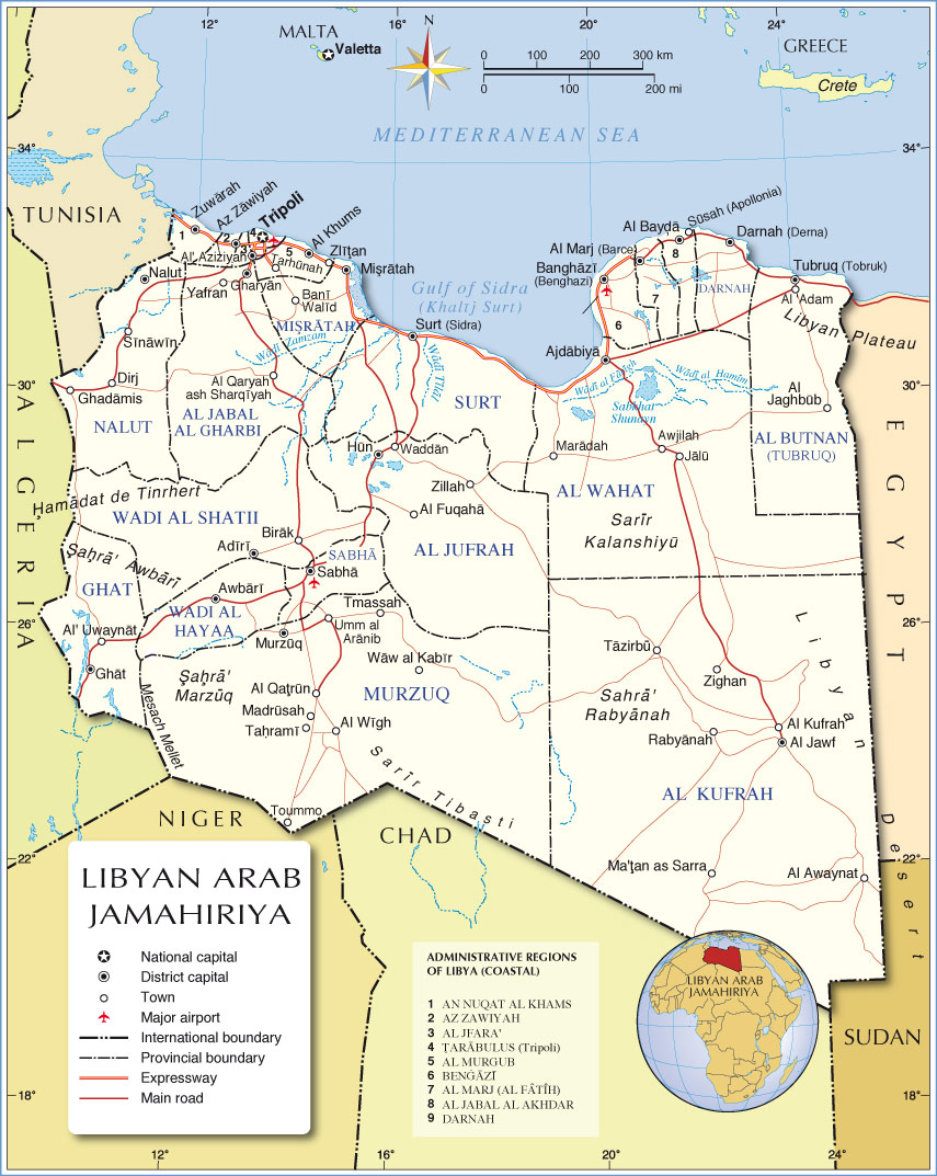 Administrative Map of Libya |
One World - Nations Online .:. let's care for this planet Promote that every nation assumes responsibility for our world. Nations Online Project is made to improve cross-cultural understanding and global awareness. More signal - less NOISE |
| Site Map
| Information Sources | Disclaimer | Copyright © 1998-2023 :: nationsonline.org |