Nations Online
All Countries in the World
Nations Online All Countries in the World | |
| Home |
___ Administrative Map of Ecuador |
| Map is showing Ecuador's primary administrative divisions. The country is divided into 24 provinces (Spanish: provincias, singular – provincia). Provinces of Ecuador (Province capital in parenthesis): Azuay (Cuenca), Bolívar (Guaranda), Cañar (Azogues), Carchi (Tulcán), Chimborazo (Riobamba), Cotopaxi (Latacunga), El Oro (Machala), Esmeraldas (Esmeraldas), Galápagos (Puerto Baquerizo Moreno), Guayas (Guayaquil), Imbabura (Ibarra), Loja (Loja), Los Ríos (Babahoyo), Manabí (Portoviejo), Morona Santiago (Macas), Napo (Tena), Orellana (Puerto Francisco de Orellana), Pastaza (Puyo), Pichincha (Quito), Santa Elena (Santa Elena), Santo Domingo de los Tsáchilas (Santo Domingo de los Colorados), Sucumbíos (Nueva Loja), Tungurahua (Ambato), Zamora-Chinchipe (Zamora) Click on the map to enlarge. 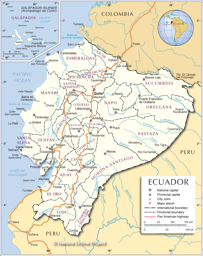 Administrative Map of Ecuador |
One World - Nations Online .:. let's care for this planet Promote that every nation assumes responsibility for our world. Nations Online Project is made to improve cross-cultural understanding and global awareness. More signal - less NOISE |
| Site Map
| Information Sources | Disclaimer | Copyright © 1998-2024:: nationsonline.org |