Nations Online
All Countries in the World
Nations Online All Countries in the World | |
| Home |
___ Satellite View and Map of Earth |
Satellite View and Map of Earth using Google Earth DataSatellite view is showing Earth with continents and oceans.Zoom in to see the countries of the world with their international borders, the national capitals, major cities, expressways and main roads. The map is showing mapped Earth, by now you can find almost any place on the planet. What to do? One possibility is, just double-click on a random point on one of the continents of the map and zoom in and enjoy the beauty of Earth. It's a little like throwing I Ging yarrow sticks. You'll always be surprised. Timetravel 1. Look for the place where you was born, or where you grown up, important places in your life. Zoom into your past and explore, you might even find the house where you were born in. 2. Look for the place where you have always wanted to go. Zoom into your future and explore. 3. Travel with the speed of light. On the map below you pick up Pegman ( |
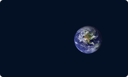 A Work of Art Image: Sent to me by an extraterrestrial friend after she left. Bookmark/share this page |
|
To find a location type: street or place, city, optional: state, country. |
Time :: Coordinated Universal Time:
Saturday-June-6 07:33
UTC/GMT |
|
φ Latitude, λ Longitude (of Map center; move the map to see coordinates): , |
||
| Google Earth: Map of Earth - Searchable map/satellite view of the World. |
||
| More about Earth: See unique masterpieces of creation. Earth facts: basic planetary data. World map showing independent states borders, dependencies or areas of special sovereignty, islands and island groups as well as capital cities. Shaded relief map of the world, showing landmasses, continents, oceans, regions, mountain ranges, islands and island groups as well as extreme points. |
More to explore: |
Related Consumer Information:
|
Map Help [ show ]  |
||
One World - Nations Online .:. let's care for this planet Promote that every nation assumes responsibility for our world. Nations Online Project is made to improve cross-cultural understanding and global awareness. More signal - less NOISE |
| Site Map
| Information Sources | Disclaimer | Copyright © 1998-2024:: nationsonline.org |
