Advertising

Home Earth Continents Asia United Arab Emirates Country Profile Map of the United Arab Emirates

Maps Index

Map of United Arab Emirates, Middle East


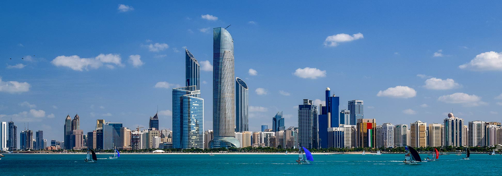
Abu Dhabi Skyline, UAE
Skyline of Abu Dhabi, the capital city of the emirate of Abu Dhabi and of the United Arab Emirates.
Image: Wadiia


About the United Arab Emirates

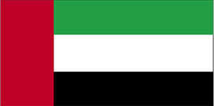
United Arab Emirates Flag
The United Arab Emirates is one of the Persian Gulf States, a desert country in the southeast of the Arabian Peninsula with a coastline at the Persian Gulf (Arab Gulf) and the Gulf of Oman. The UAE is bordering Oman and Saudi Arabia and has maritime borders with Iran. There is a disputed region in the west of the Emirate of Abu Dhabi; therefore it is unclear if the UAE actually has a border with Qatar. [1]

The coastal region of today UAE was known for a long time as the Pirate Coast. The seafaring inhabitants made a living by pirating trade vessels in the area. The loose federation of sheikdoms came under British administration in the mid 19th century, then known as the Trucial States until 1971, with the independence from the UK.

The UAE came into existence in December 1971 when six emirates formed a federation: Abu Dhabi, Dubai, Sharjah, Ajman, Umm Al-Quwain, and Fujairah; Ras Al Khaimah joined the alliance in 1972.

With an area of 83,600 km², the United Arab Emirates is about the size of Austria, or slightly smaller than the US State of Maine. The country consists mostly of barren landscape with gravel plains and desert dunes, interspersed with some oases, best known is Liwa Oasis, north of the Rub' al Khali, the Empty Quarter, the largest sand desert in the world. Along the coast stretches a strip of marshes (sabkha;) low-lying saline flats, lagoons, intertidal mudflats, and mangrove swamps. There is a mountainous region in the northeast; Jabal Yibir (1,527 m) the countries highest point is situated there.

The United Arab Emirates has a population of 9.37 million people (in 2018), with the male population being twice as large as the female population. The capital city of the UAE is Abu Dhabi; the largest city is Dubai. Spoken languages are an Emirates variant of Arabic, English is in use.


Map of United Arab Emirates

Map of the United Arab Emirates, Arabia
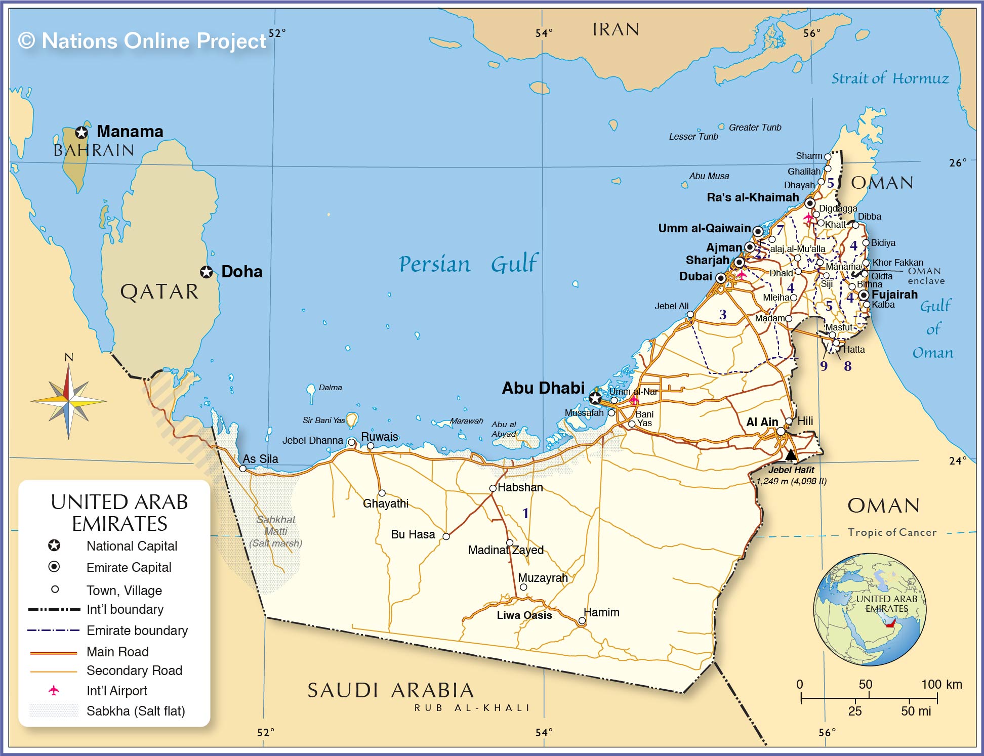
Political Map of United Arab Emirates

The map shows the United Arab Emirates and neighboring countries with international borders, emirate boundaries, the national capital Abu Dhabi, emirate capitals, major cities, main roads, and major airports.

You are free to use above map for educational purposes, please refer to the Nations Online Project.


More about United Arab Emirates


Administrative Divisions of UAE

The United Arab Emirates is a federation of seven emirates, their capitals have the same name as the emirate:
(see the map)
(1) Abu Dhabi
(2) Ajman: 1 exclave
(3) Dubai: 1 exclave
(4) Fujairah: 2 exclaves
(5) Ras al-Khaimah: 1 exclave
(6) Sharjah: 3 exclaves
(7) Umm al-Quwain

Areas under joint control:
(8) Fujairah and Sharjah
(9) Oman and Ajman

Disputed Areas:
The islands of Lesser Tunb, Greater Tunb, and Abu Musa are under Iranian administration but claimed by UAE.


Cities and Towns in the United Arab Emirates

Map shows the location of following cities and towns:

Ajman, Al Ain, As Sila, Bani Yas, Baynunah, Bida Zayed, Bidiya, Bithna, Bu Hasa, Dhaid, Dhayah, Dibba, Digdagga, Dubai, Falaj al-Mu’alla, Fujairah, Ghalilah, Habshan, Hamim, Hatta, Hili, Jebel Ali, Jebel Dhanna, Kalba, Khatt, Khor Fakkan, Madam, Manama, Masfut, Mleiha, Mussafah, Muzayrah, Qidfa, Ra's al-Khaimah, Ruwais, Sharjah, Sharm, Siji, Umm al-Nar, and Umm al-Qaiwain.


Bookmark/share this page
  Instagram button

Weather Conditions in the United Arab Emirates:

ABU DHABI WEATHER


Advertisements:


Political Maps of other Countries in the Middle East:
Bahrain Map, Cyprus Map, Egypt Map, Iran Map, Iraq Map, Israel Map, Jordan Map, Kuwait Map, Lebanon Map, Oman Map, Qatar Map, Saudi Arabia Map, Syria Map, Turkey Map, Yemen Map 
up