
| Home |
|
___ Administrative Map of Samoa |
Map is showing the Independent State of Samoa (formerly known as Western Samoa) with provincial boundaries, the national capital Apia, district capital villages, major towns, main roads, and major airports. Border Countries: American Samoa |
 One World - Nations Online all countries of the world |
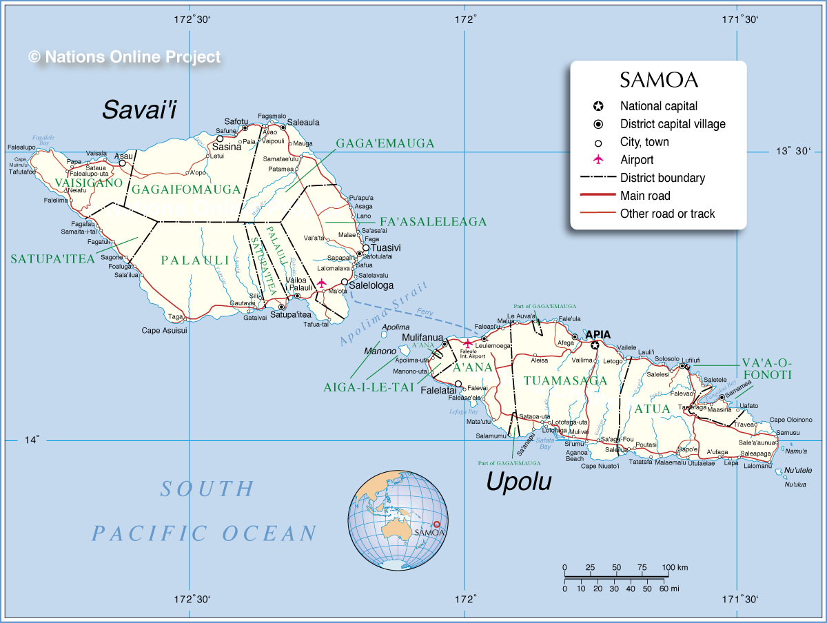 Administrative Map of Samoa |
||||||
|
More about Samoa |
Apia Current Weather Conditions at Faleolo International Airport
|
Related Consumer Information: |
||||
Maps of other countries in Australia/Oceania and the Pacifics: Australia Map, New Caledonia Map, New Zealand Map, Papua New Guinea Map All Countries and Territories of Australia/Oceania Countries of the World: A - C | D - G | H - L | M - P | Q - T | U - Z Continents: Africa | The Americas | Asia | Europe |
One World - Nations Online .:. let's care for this planet Every nation is responsible for the current state of our world. |
| Site Map
| Information Sources | Disclaimer: Privacy Policy, etc. Contact: [email protected] | Copyright © 1998-2021 :: nationsonline.org |
