
| Home |
|
|
|
___ Political Map of Lao People's Democratic Republic (Laos) | |
About Laos |
|
| The map shows Laos or Lao, a landlocked country on the IndoChina Peninsulasoutheast Asia, formerly part of (French) Indochina, that encompassed modern day Vietnam, Cambodia and Laos. The country is also bordered by Thailand, China and Myanmar (Burma). Laos became independent in 1953, but for most of the next 25 years was torn by civil strife between the communist Pathet Lao movement and government supporters. In 1975, the Pathet Lao achieved total control, and a communist republic was established. The end of the 20th century saw a gradual return to free enterprise. The country has a population of 7 million inhabitants (2015 est.). Capital and largest city is Vientiane (Viang Chan) with an estimated population of 580,000 people. Spoken language are Laotian (official) and Thai. Map is showing Laos and the surrounding countries with international borders, provinces and provincial boundaries, the national capital Vientiane, provincial capitals, major cities and towns, main roads, and major airports. |
 Bookmark/share this page |
 One World - Nations Online all countries of the world |
|
|
||
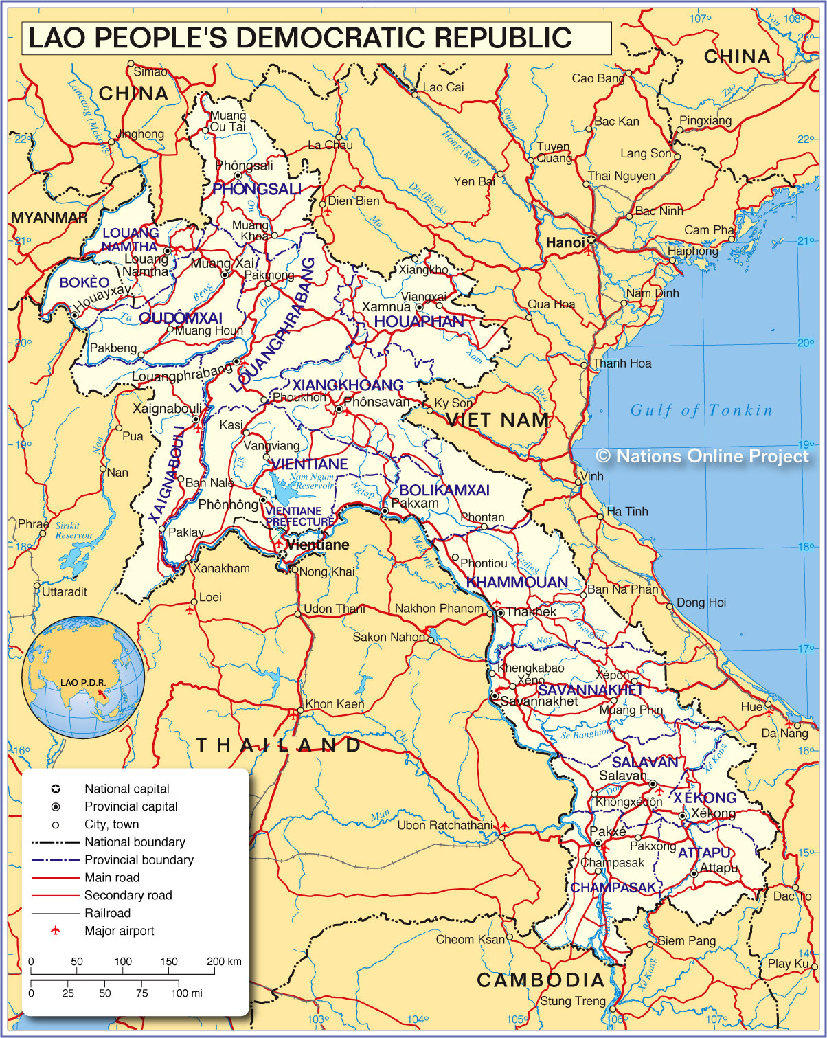 Political Map of Laos Map based on a UN map. Source: UN Cartographic Section Cities: Attapeu, Champasak, Houayxay, Kasi, Keng Kabao, Khongxedon, Lak Sao, Luang Namtha, Luang Prabang, Muang Khoun, Muang Khua, Muang Phin, Muang Xay, Nan Bak, Nongchan, Ou Tai, Pak Beng, Pak Lay, Paksan, Pakse, Paksong, Phôn-Hông, Phongsali, Phonsavan, Phontan, Phoukhon, Salavan, Savannakhet, Sekong, Thakhek, Vang Vieng, Viang Xai, Vientiane, Xam Neua, Xayaboury, Xeno, and Xepon |
||||||
| More about Laos: Landmarks: Laos' national monument. A Khmer Hindu temple complex. Cities: (capital city) Country: Lao PDR Key Statistical Data. Continent: |
Vientiane Current Weather Conditions:
|
Related Consumer Information: |
||||
Maps of other countries in Southeast and Eastern Asia: Bangladesh Map, Bhutan Map, Cambodia Map, China Map, India Map, Indonesia Map, Japan Map Korea (North), Korea (South), Malaysia Map, Maldives Map, Mongolia Map, Myanmar Map Nepal Map, Pakistan Map, Philippines Map Singapore Map, Sri Lanka Map, Taiwan Map, Thailand Map, Vietnam Map | ||||||
One World - Nations Online .:. let's care for this planet Every nation is responsible for the current state of our world. |
| Site Map
| Information Sources | Disclaimer: Privacy Policy, etc. Contact: [email protected] | Copyright © 1998-2021 :: nationsonline.org |
