Nations Online
All Countries in the World
Nations Online All Countries in the World | |
| Home |
___ Administrative Map of Hungary |
| Map is showing Hungary and the surrounding countries with international borders, county boundaries, county capitals, and the national capital Budapest. Primary Administrative Regions of HungaryHungary is divided into 20 regions comprising 19 counties (megyék, singular: megye) and the capital city (főváros): Budapest.The map shows Hungary's counties and their capital cities (in parenthesis): Bács-Kiskun (Kecskemét), Baranya (Pécs), Békes (Békéscsaba), Borsod-Abaúj-Zemplén (Miskolc), Csongrád (Szeged), Fejér (Székesfehérvár), Győr-Moson-Sopron (Győr), Hajdú-Bihar (Debrecen), Heves (Eger), Jász-Nagykun-Szolnok (Szolnok), Komárom-Esztergom (Tatabánya), Nógrád (Salgótarján), Pest (Budapest), Somogy (Kaposvár), Szabolcs-Szatmár-Bereg (Nyíregyháza), Tolna (Szekszárd), Vas (Szombathely), Veszprém (Veszprém), and Zala (Zalaegerszeg). Click on the map for a Political Map of Hungary. 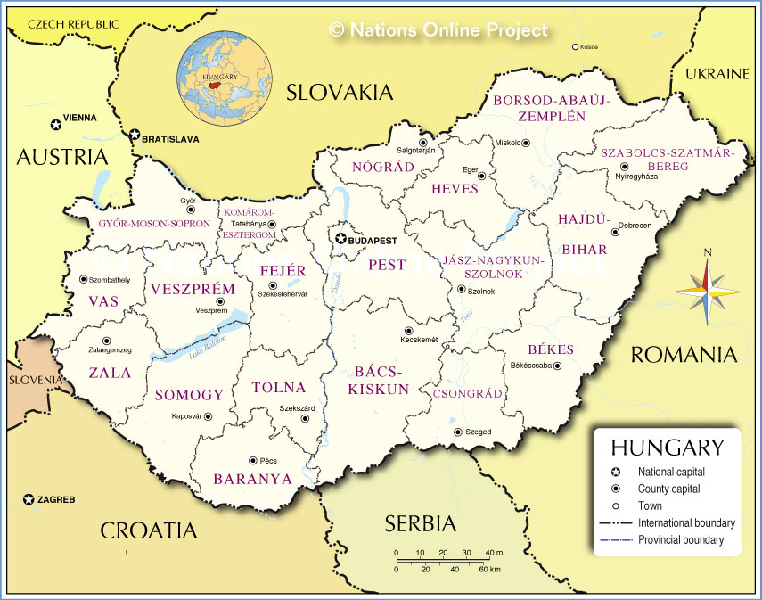 Administrative Map of Hungary |
One World - Nations Online .:. let's care for this planet Promote that every nation assumes responsibility for our world. Nations Online Project is made to improve cross-cultural understanding and global awareness. More signal - less NOISE |
| Site Map
| Information Sources | Disclaimer | Copyright © 1998-2023 :: nationsonline.org |