Nations Online
All Countries in the World
Nations Online All Countries in the World | |
Home  |
___ Satellite View and Map of the City of Vancouver, Canada |
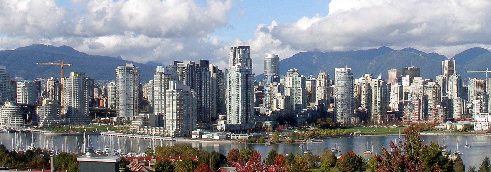 Vancouver skyline behind False Creek. Image: Thom Quine |
About Vancouver Satellite view is showing Vancouver, largest city in the Canadian province of British Columbia and the third largest in Vancouver has a city population of about 600,000 inhabitants, 2.3 million live in the metropolitan area (Census 2011). The city's scenic location makes it a major tourist destination. Economically the city has become an increasingly important center for software development, biotechnology and the third-largest film and television production industry in North America. The city has often been ranked one of the most livable cities in the world. As of 2010, Vancouver has been ranked as having the 4th highest quality of life of any city on Earth (source: Mercer). Vancouver was host to the 2010 Winter Olympics and the Paralympics. The Map shows a city map of Vancouver with expressways, main roads and streets, and the location of Vancouver International Airport (IATA Code: YVR) on Sea Island in Richmond. Just zoom in to see Vancouver City Hall. The Art Deco building from 1936 is the seat of Vancouver City Council. To find a location use the form below. To see just the map click on the "Map" Button. |
|
| To find a location type: street or place, city, optional: state, country. |
Local Time Vancouver:
Monday-April-22 04:03
Standard time zone Pacific Standard Time (PST): UTC/GMT -8 hoursPacific Daylight Time (PDT) in use from the first Sunday in March, ends on the first Sunday in November; time zone offset: UTC/GMT -7 hours |
|
φ Latitude, λ Longitude (of Map center; move the map to see coordinates): , |
||||||
| Sorry! Google's pricing policy has made it impossible for us to continue showing Google Maps. We apologize for any inconvenience. Google Map: Searchable map/satellite view of the city of Vancouver, British Columbia, Canada. City Coordinates: 49°15′N 123°6′W |
Bookmark/share this page |
|||||
| More about Canada: Cities: Searchable map and satellite view of other major cities of Canada: Country: Canada key statistical figures. Continent: |
Weather Conditions Vancouver
External Links: Vancouver Official website of the City of Vancouver. Tourism Vancouver Official tourism website of Vancouver. Vancouver Newspaper Vancouver Sun Vancouver broadsheet. The Province Vancouver tabloid. Wikipedia: Vancouver Wikipedia article about Vancouver. |
Related Consumer Information:
|
||||
Major Canadian Cities: Major U.S. Cities: Atlanta, Atlantic City, Austin, Baltimore, Boston, Charlotte, Chicago, Cincinnati, Cleveland, Columbus, Dallas, Denver, Detroit, El Paso, Fort Worth, Honolulu, Houston, Indianapolis, Jacksonville, Kansas City, Las Vegas, Long Beach, Los Angeles, Memphis, Miami, Milwaukee, Minneapolis, Nashville, New Orleans, New York City, Norfolk, Oklahoma City, Orlando, Philadelphia, Phoenix, Pittsburgh, Portland, Sacramento, St. Louis, San Antonio, San Diego, San Francisco, San Jose, Santa Fe, Seattle, Tampa, Tucson, Washington D.C. |
Map Help [ show ] |
One World - Nations Online .:. let's care for this planet Promote that every nation assumes responsibility for our world. Nations Online Project is made to improve cross-cultural understanding and global awareness. More signal - less NOISE |
| Site Map
| Information Sources | Disclaimer | Copyright © 1998-2023 :: nationsonline.org |


