Nations Online
All Countries in the World
Nations Online All Countries in the World | |
Home  |
___ Satellite View and Map of the City of Tangier (Tamazight: Tanja), Morocco |
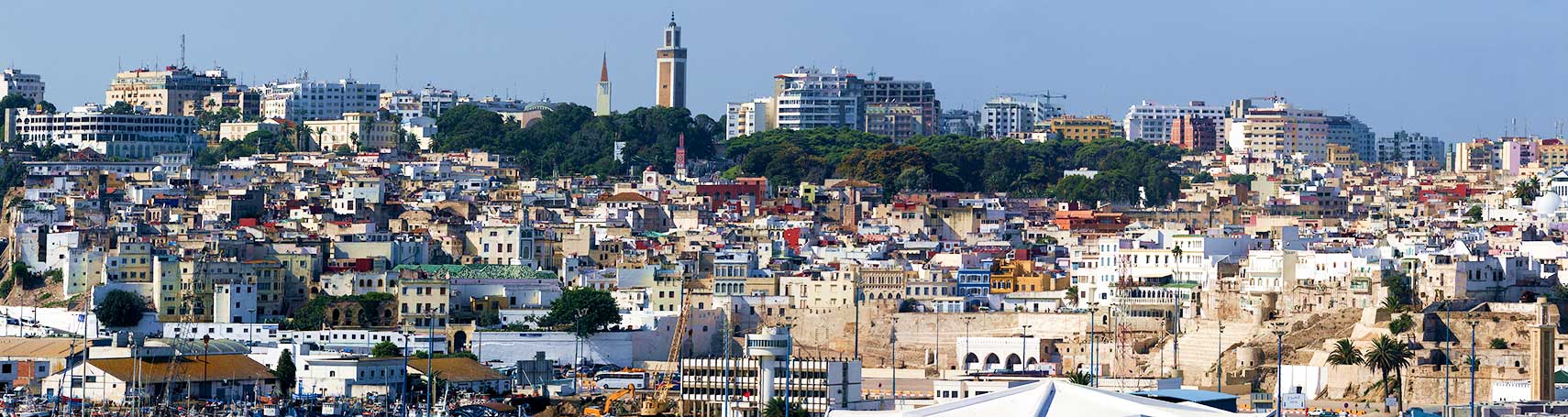 Tangier - the Moroccan port city seen from the harbor. Image: Börste |
About Tangier Satellite view is showing Tangier, also known as the White City, is an important seaport on the northern coast of Satellite view is showing Tangier, also known as the White City, is an important seaport on the northern coast of Tangier is an ancient city, in the early 5th century BC the bay on the Strait of Gibraltar was one of the many Phoenician trading posts in the Mediterranean, it became a permanent Carthaginian settlement until 81 BC the port (then known as Tingis) came under Roman control and later became the capital of the Roman province of Mauretania Tingitana. 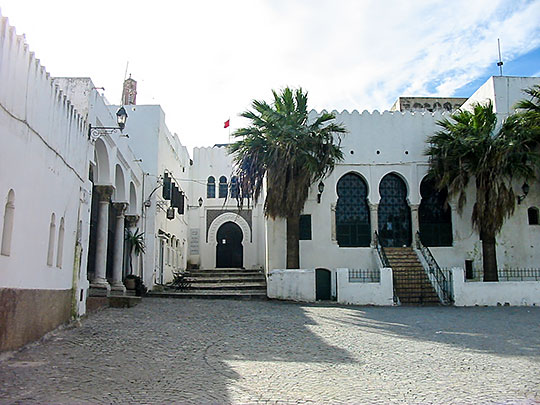 Dar el Makhzen, the Sultan palace in the heart of the Kasbah of Tangier. Dar el Makhzen, the Sultan palace in the heart of the Kasbah of Tangier.Image: Bpcorps From 1923 to 1924 it was part of an internationally administered zone and was returned to international control following World War II, during which it was administered by Spain. Today Tangier has a population of nearly 1 million people (in 2014). Spoken languages are Darija (Moroccan Arabic), Tarifit (a Riff Berber language, colloquial: Tamazight), French is widely used, English and Spanish are generally understood in tourist areas. Some points of interest in or near Tangier: Grand Socco, the Big Square (Place du Grand 9 Avril 1947) in the medina area of central Tangier, transforms in the evening into a particularly colorful market; nearby are the former Forbes Museum of Tangier, and the Anglican Church of St. Andrew. Dar el Makhzen, the former palace of Sultan Moulay Ismail is today home of the Museum of Moroccan Arts and Antiquities. Casabarata (giant flea market); Caves of Hercules (Early backpacker Hercules slept in these caves before attempting one of his 12 labors). Librairie des Colonnes (best bookshop in town). The map shows a city map of Tangier with expressways, main roads and streets, and the location of Tangier-Boukhalef Airport (IATA code: TNG). To find a location use the form below. |
|
| To find a location type: street or place, city, optional: state, country. |
Local Time Casablanca:
Tuesday-April-16 00:38
No UTC/GMT offset |
One World - Nations Online .:. let's care for this planet Promote that every nation assumes responsibility for our world. Nations Online Project is made to improve cross-cultural understanding and global awareness. More signal - less NOISE |
| Site Map
| Information Sources | Disclaimer | Copyright © 1998-2023 :: nationsonline.org |

