Nations Online
All Countries in the World
Nations Online All Countries in the World | |
Home  |
___ Satellite View and Map of the City of Rabat (الرباط), Morocco |
About Rabat
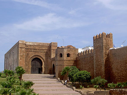 Main gate of the Kasbah of the Udayas in Rabat. Rabat has a population of about 1.2 million inhabitants. Just zoom in(+) to see the Royal Palace, the official residence of Mohammed VI, King of Morocco.. |
|
| To find a location type: street or place, city, optional: state, country. |
Local Time Morocco:
Monday-April-22 01:00
No UTC/GMT offset |
One World - Nations Online .:. let's care for this planet Promote that every nation assumes responsibility for our world. Nations Online Project is made to improve cross-cultural understanding and global awareness. More signal - less NOISE |
| Site Map
| Information Sources | Disclaimer | Copyright © 1998-2023 :: nationsonline.org |
 Satellite view is showing Rabat, seaport and the capital of
