Nations Online
All Countries in the World
Nations Online All Countries in the World | |
Home  |
___ Satellite View and Map of the City of Ottawa (Ville d'Ottawa), Ontario, Canada |
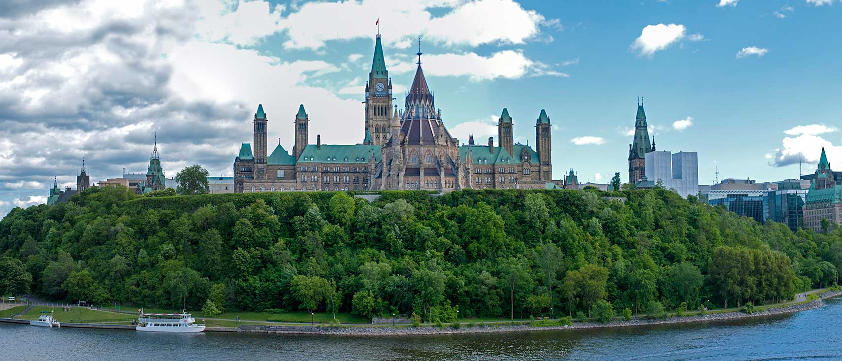 Parliament Hill in Ottawa at Ottawa River. The Hill is dominated by the Gothic Revival style Parliament of Canada Buildings. The Centre Block behind the Peace Tower houses the Senate and Commons chambers. The Parliament complex was built between 1859 to 1865. Image: David Samuel |
About Ottawa |
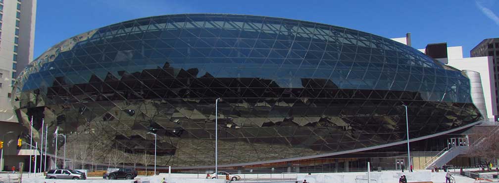
 Satellite view is showing Ottawa, the country's fourth largest city and the national capital of 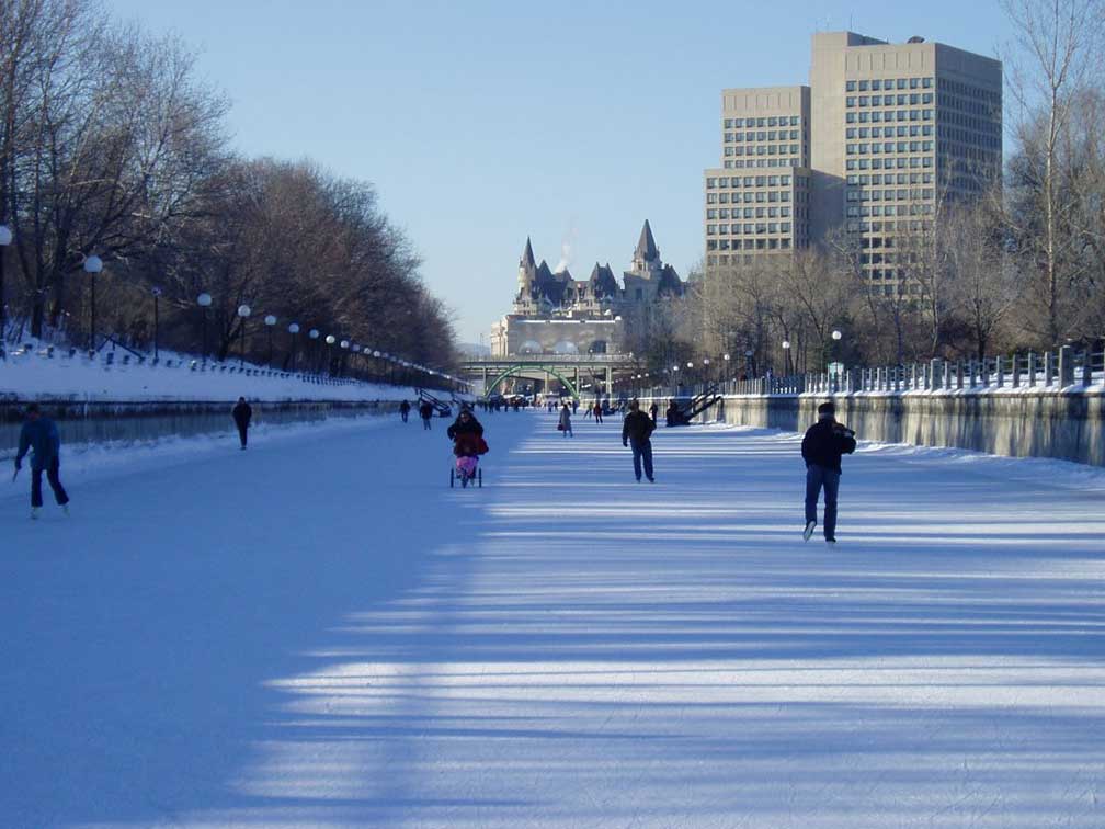 Rideau Canal in downtown Ottawa, some say in winter the canal becomes the longest skating rink in the world. The construction of the canal, built in 1832, was a military project to provide a secure route between Montreal and the city of Kingston on Lake Ontario in times when Great Britain and the United States rivaled for the control of the region. Today the Rideau Canal Photo: SimonP Today the city has a population of about 880,000 inhabitants, more than 1.2 million people live in the Ottawa-Gatineau metropolitan area (Census 2011). Spoken languages are English (predominant) and French. Ottawas climate can offer extremely hot and humid summers and extremely cold winters. In Mercers Top 50 cities: Eco-City ranking 2010, Ottawa ranks #3 after Calgary, Alberta, Canada and the city of Honolulu, Hawaii. The city is home to Ottawa University and the Carleton University. Ottawa points of interest: Places: Château Laurier (stylish French Gothic luxury hotel), Shaw Centre (futuristic style convention center with a ballroom and a theater), Lord Elgin Hotel (landmark hotel in downtown), Laurier House (historical landmark), Museums: National Gallery of Canada (premier art gallery), Canadian Museum of Contemporary Photography (closed, now part of the National Gallery of Canada), Canadian Museum of Nature (natural history museum), Canada Aviation and Space Museum (national aviation history museum), Canadian War Museum (Canada's national museum of military history), Canada Agriculture Museum (science and technology of farming), Bytown Museum (history of Bytown) Performing arts: National Arts Centre (major performing arts venue), Centrepointe Theatre (performance hall) Churches: Notre-Dame Cathedral Basilica (Neo-classical minor basilica, oldest and largest church in Ottawa) Parks: Major's Hill Park (public park near Notre-Dame Cathedral and the American Embassy), Dominion Arboretum (ornamental botanical garden with a lake (Dow's Lake)), Green Island and Rideau Falls (one island, two waterfalls), Dundonald Park (public park in Centretown), Calypso Park (theme waterpark) Sports: Canadian Tire Centre (multi-purpose indoor arena) Just zoom in (+) to see Parliament Hill, with the Parliament Buildings, seat of the Parliament of Canada. The Map shows a city map of Ottawa with expressways, main roads and streets, Ottawa Macdonald-Cartier International Airport (IATA Code: YOW) to the south. To find a location like Ottawa City Hall or Ottawa Hospital General Campus use the form below. To see just the map click on the "Map" Button. |
|
| To find a location type: street or place, city, optional: state, country. |
Local Time Ottawa:
Thursday-April-18 2024 14:56
Standard time zone Eastern (EST): UTC/GMT -5 hoursDaylight Saving Time (EDT) in use from the first Sunday in March ends on the first Sunday in November; time zone offset: UTC/GMT -4 hours |
|
φ Latitude, λ Longitude (of Map center; move the map to see coordinates): , |
||||||
| Google Earth: Searchable Map and Satellite View of the City of Ottawa, Canada. Coordinates: 45°25′15″N 75°41′24″W |
Bookmark/share this page |
|||||
| More about Canada: Cities: Searchable map and satellite view of other major cities of Canada: Country: Canada statistical key figures. Continent: |
Current Weather Conditions Ottawa
External Links: City of Ottawa Ottawa's official web site. Ottawa Ottawa's official tourism website. Newspaper: Ottawa Citizen Local and national news. Ottawa Sun Local and national news. Wikipedia: Ottawa Wikipedia article about the city of Ottawa. |
Related Consumer Information:
|
||||
|
Major U.S. Cities: Atlanta, Atlantic City, Austin, Baltimore, Boston, Charlotte, Chicago, Cincinnati, Cleveland, Columbus, Dallas, Denver, Detroit, El Paso, Fort Worth, Honolulu, Houston, Indianapolis, Jacksonville, Kansas City, Las Vegas, Long Beach, Los Angeles, Memphis, Miami, Milwaukee, Minneapolis, Nashville, New Orleans, New York City, Norfolk, Oklahoma City, Orlando, Philadelphia, Phoenix, Pittsburgh, Portland, Sacramento, St. Louis, San Antonio, San Diego, San Francisco, San Jose, Santa Fe, Seattle, Tampa, Tucson, Washington D.C. |
||
Map Help [ show ] |
||
One World - Nations Online .:. let's care for this planet Promote that every nation assumes responsibility for our world. Nations Online Project is made to improve cross-cultural understanding and global awareness. More signal - less NOISE |
| Site Map
| Information Sources | Disclaimer | Copyright © 1998-2023 :: nationsonline.org |