Nations Online
All Countries in the World
Nations Online All Countries in the World | |
Home  |
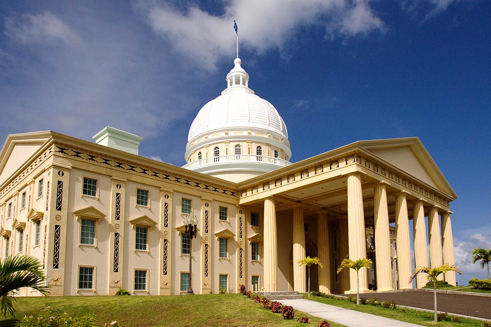
___ Satellite View and Map of Ngerulmud, Melekeok, Palau |
Satellite View of Ngerulmud using Google Earth DataSatellite view is showing Ngerulmud, a settlement in the State of Melekeok on the island of Palau's largest island Babeldaob, it is the capital ofPalau is an island nation in the northern Pacific Ocean, located about 900 km east of the Philippines and 900 km north of the Indonesian part of New Guinea (West Papua). Zoom in to see the Palau's Capitol building. Zoom out to find the location of Roman Tmetuchl International Airport (IATA code: ROR) located in south of the island, 6 miles (4 km) from Koror and 15 miles (25 km) from Melekeok. To find a location use the form below. |
|
| To find a location type: street or place, city, optional: state, country. |
Local Time Palau:
Wednsday-April-24 20:17
Time zone: Palau Time (PWT) :: UTC/GMT +9 hours |
|
φ Latitude, λ Longitude (of Map center; move the map to see coordinates): , |
||||||
| Sorry! Google's pricing policy has made it impossible for us to continue showing Google Maps. We apologize for any inconvenience. Google Map: Map of Ngerulmud settlement with Capitol building, Melekeok, Palau. City Coordinates: 7°30′2″ N, 134°37′27″ E |
Bookmark/share this page |
|||||
| More about Palau: Island: Continent: External Link: Wikipedia: Ngerulmud |
Weather Conditions Palau:
|
Related Consumer Information:
|
||||
Other Micronesian Island Nations: Guam, Hawaii, Kiribati, Marshall Islands, Micronesia (Federated States of), Nauru, Northern Mariana Islands |
||||||
One World - Nations Online .:. let's care for this planet Promote that every nation assumes responsibility for our world. Nations Online Project is made to improve cross-cultural understanding and global awareness. More signal - less NOISE |
| Site Map
| Information Sources | Disclaimer | Copyright © 1998-2023 :: nationsonline.org |