Nations Online
All Countries in the World
Nations Online All Countries in the World | |
Home  |
___ Satellite View and Map of the City of Nassau, Bahamas |
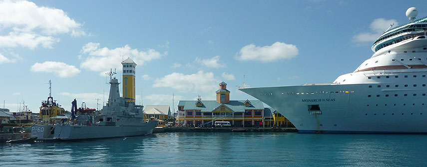 Cruiseship Monarch of the Seas at Nassau Bahamas Cruise Terminal in front of Festival Place building. Image: Lisa Jacobs |
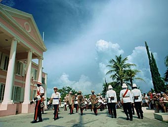
About New Providence island and the city of Nassau Satellite view is showing Nassau, a bustling metropolitan hub and the national capital of the Commonwealth of Satellite view is showing Nassau, a bustling metropolitan hub and the national capital of the Commonwealth of Nassau has a population of about 250,000 inhabitants (in 2010), about 70% of the entire population of The Bahamas (350,000). Official language is English. Some points of interest: National Art Gallery of The Bahamas, Atlantis Paradise Island (resort and waterpark), Blue Lagoon Island (local tourist attraction), Ardastra Gardens & Zoo, Junkanoo (parade), Pirates of Nassau (museum), Government House (residence of the Governor General), Fort Charlotte (British-colonial era fort), Fort Montagu (18th century fort), Athol Island (part of the National Marine Park). Just zoom in (+) to see Downtown Nassau and Prince George Wharf, the main port and ferry terminal of the city. The Map shows a city map of Nassau with main roads and streets, and Lynden Pindling International Airport (IATA Code: NAS) is located about 16 km (10 mi) west of Nassau City. To find a location use the form below. |
|
| To find a location type: street or place, city, optional: state, country. |
Local Time Bahamas:
Thursday-April-18 2024 12:24
Standard time zone Eastern (EST): UTC/GMT -5 hoursDaylight Saving Time (EDT) in use from the second Sunday in March, ends on the first Sunday in November; time zone offset: UTC/GMT -4 hours |
One World - Nations Online .:. let's care for this planet Promote that every nation assumes responsibility for our world. Nations Online Project is made to improve cross-cultural understanding and global awareness. More signal - less NOISE |
| Site Map
| Information Sources | Disclaimer | Copyright © 1998-2023 :: nationsonline.org |