Nations Online
All Countries in the World
Nations Online All Countries in the World | |
Home  |
___ Satellite View and Map of the City of Luanda, Angola |
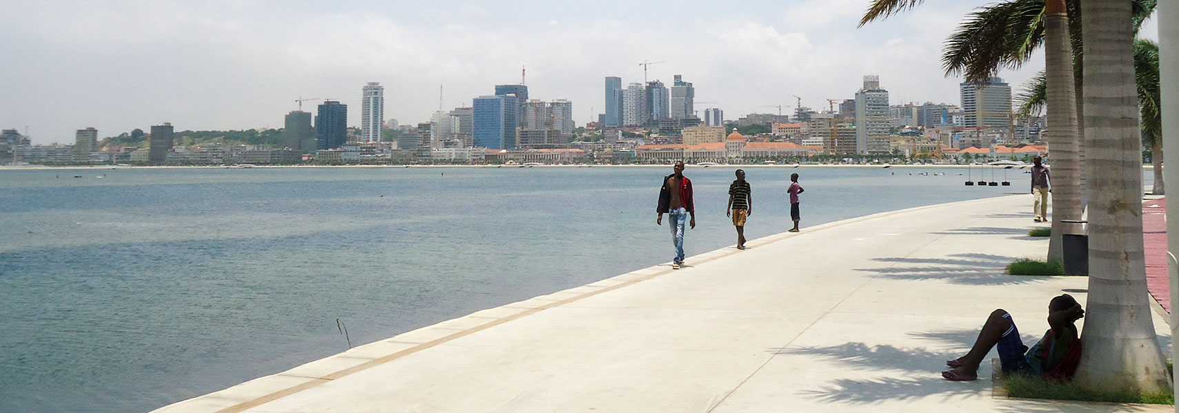 Luanda's Avenida 4 de Fevreiro along Luanda Bay. Image: Fabio Vanin |
About LuandaSatellite view is showing Luanda, chief seaport, largest city and the national capital ofThe city was founded as São Paulo da Assunção de Loanda (St. Paul de Loanda) by the Portuguese explorer Paulo Dias de Novais in 1575. The port city served as the center of the Portuguese slave trade until the beginning of the 19th century. The population of Luanda has exploded in recent years, about one-third of Angola's population live in Luanda, the city has a population of more than 5 million inhabitants. 50% of its residents live in poverty but Luanda is the world's most expensive city for expatriates, according to Mercer's 2011 'Cost of Living Survey'. The city won the somewhat dubious accolade for the second year. Luanda is currently undergoing a major reconstruction, with many large developments taking place which will alter the cityscape significantly. Angola's capital is the administrative, commercial, and educational center of the country, spoken language is Portuguese, several Bantu languages are also in use. Just zoom in (+) to see Luanda's Rocket monument, a massive kind of tombstone built in honor of Angola's first president António Agostinho Neto. The map shows a city map of Luanda with expressways, main roads and streets, and the location of Quatro de Fevereiro Airport (IATA code: LAD). To find a location use the form below. |
| To find a location type: street or place, city, optional: state, country. |
|
φ Latitude, λ Longitude (of Map center; move the map to see coordinates): , |
||||||
| Google Earth: Satellite view and map of Luanda, Angola. City coordinates: 8°50′18″S 13°14′4″E |
Bookmark/share this page |
|||||
| More about Angola: Country: Continent: |
Weather Conditions Luanda
External Links: Wikipedia: Luanda Wikipedia article about Luanda. |
Related Consumer Information:
|
||||
Other Capital cities in Central Africa Bangui, Brazzaville, Kinshasa, Libreville, Malabo, N'Djamena, São Tomé, Yaounde Countries and Territories of Africa |
||||||
Map Help [ show ] |
||||||
One World - Nations Online .:. let's care for this planet Promote that every nation assumes responsibility for our world. Nations Online Project is made to improve cross-cultural understanding and global awareness. More signal - less NOISE |
| Site Map
| Information Sources | Disclaimer | Copyright © 1998-2023 :: nationsonline.org |