Nations Online
All Countries in the World
Nations Online All Countries in the World | |
Home  |
___ Satellite View and Map of the City of Brazzaville, Republic of the Congo |
Searchable Map and Satellite View of Brazzaville using Google Earth Data
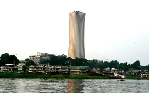
Brazzaville has a population of more than 1 million inhabitants. Spoken languages in the country are French (official) and 62 native African languages. The map shows a city map of Brazzaville with expressways, main roads and streets, zoom out to find the location of Maya-Maya Airport (IATA code: BZV). To find a location use the form below. |
|
| To find a location type: street or place, city, optional: state, country. |
Local Time Republic of the Congo:
Wednsday-April-24 08:58
West Africa Time (WAT) :: UTC/GMT +1 hours |
|
φ Latitude, λ Longitude (of Map center; move the map to see coordinates): , |
||||||
| Google Maps: Searchable map/satellite view of Brazzaville, Republic of the Congo, on the other side of the river lies Kinshasa, capital of the Democratic Republic of the Congo. City Coordinates: 4°16′4″S 15°17′31″E |
Bookmark/share this page |
|||||
| More about the Republic of the Congo: Country: Continent: External Link: Wikipedia Brazzaville |
Brazzaville Weather Conditions
|
Related Consumer Information:
|
||||
Other Capital cities in Central Africa Bangui, Kinshasa, Libreville, Luanda, Malabo, N'Djamena, São Tomé, Yaounde Countries and Territories of Africa |
||||||
Map Help [ show ] |
||||||
One World - Nations Online .:. let's care for this planet Promote that every nation assumes responsibility for our world. Nations Online Project is made to improve cross-cultural understanding and global awareness. More signal - less NOISE |
| Site Map
| Information Sources | Disclaimer | Copyright © 1998-2023 :: nationsonline.org |