
| Home |
|
|
|
___ Administrative Map of Equatorial Guinea |
|
About Equatorial Guinea |
|
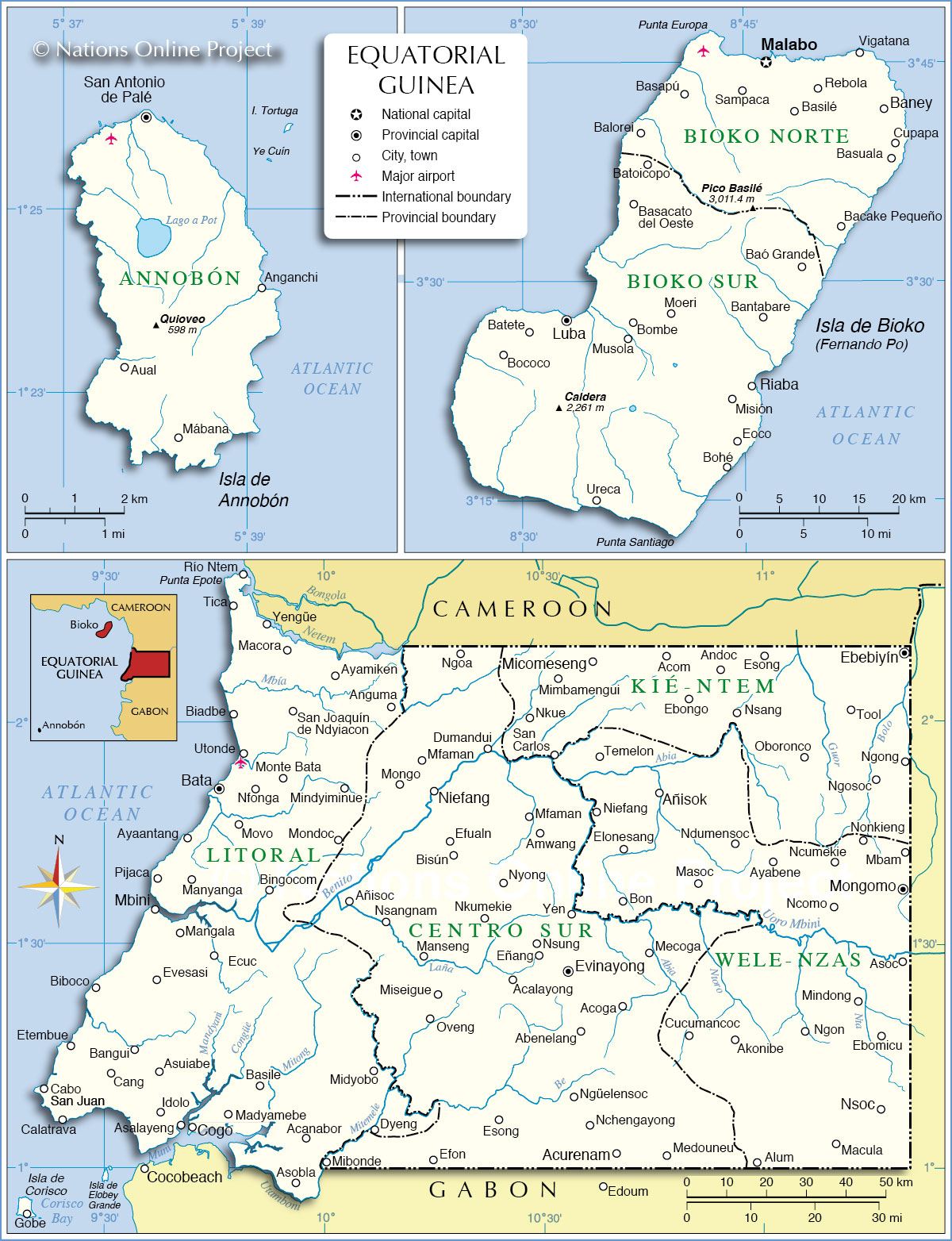
| Equatorial Guinea is comprised of the Continental Region (Río Muni) on the African mainland and five inhabited islands in the Bight of Biafra (Atlantic Ocean). The map shows Equatorial Guinea with surrounding countries, international borders, provinces boundaries, the national capital Malabo on the island of Bioko (Isla de Bioko, formerly known as Fernando Poo), province capitals, major cities, main roads, and airports. Border Countries: Cameroon, Gabon, Equatorial Guinea shares maritime borders with Nigeria and São Tomé and Príncipe. Administrative Regions of Equatorial Guinea Equatorial Guinea is divided in seven provinces. Provinces of Equatorial Guinea (province capitals appear in brackets): 1. Annobón Province on the island Annobón (San Antonio de Palé) 2. Bioko Norte Province on the island Bioko (Malabo) 3. Bioko Sur Province on the island Bioko (Luba) Provinces on African mainland; the Continental Region (Río Muni): 4. Centro Sur Province (Evinayong) 5. Kié-Ntem Province (Ebebiyín) 6. Litoral Province (Bata) includes the islands of the Corisco Bay. 7. Wele-Nzas Province (Mongomo) |
 Bookmark/share this page |
 One World - Nations Online All Countries of the World |
 Administrative Map of Equatorial Guinea Map based on a UN map. Source: UN Cartographic Section | ||||||
| More about Equatorial Guinea |
Malabo Weather Conditions:
|
Related Consumer Information: |
||||
One World - Nations Online .:. let's care for this planet Every nation is responsible for the current state of our world. |
| Site Map
| Information Sources | Disclaimer: Privacy Policy, etc. Contact: [email protected] | Copyright © 1998-2021 :: nationsonline.org |
