
| Home |
___ Antique Map of the World |
World Map "Nova Totius Terrarum Orbis Geographica Ac Hydrographica Tabula
Van Den Keere's hand colored decorative map of the World was first issued in 1608, it shows the then known regions of Europe, Africa, Asia, America and Terra Australis Incognita (Latin for "the unknown land of the South"), the large continent on the bottom of the map. In the 17th century it was a hypothetical continent. |
 One World - Nations Online countries of the world |
|
|
|
||
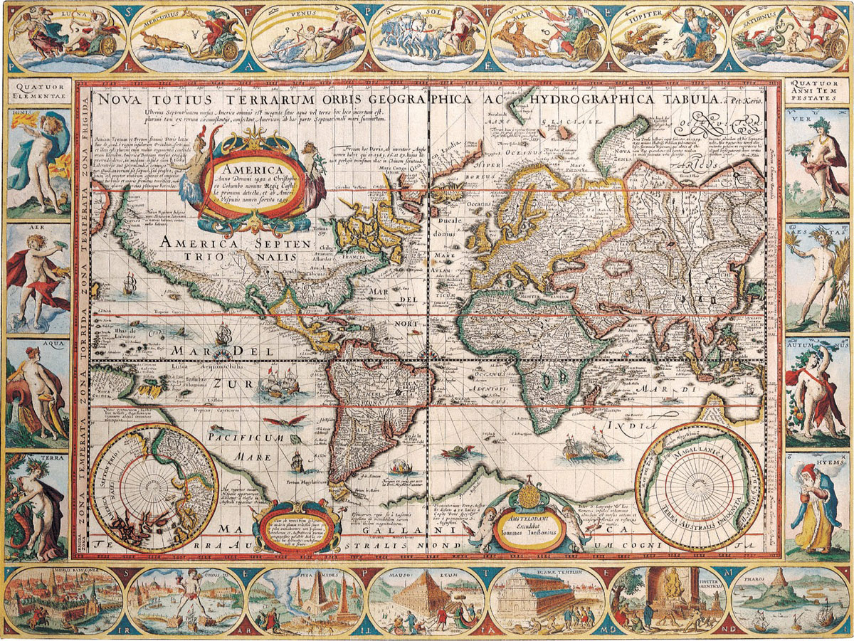 Van Den Keere's decorative Map of the World from beginning 17th century. |
||
Related Categories:Maps of the WorldContinents and regions of the world. Have a look from space at our planet. Free blank map of the world for educational purposes. World map showing independent states borders, dependencies or areas of special sovereignty, islands and island groups as well as capital cities. Shaded relief map of the world, showing landmasses, continents, oceans, regions, mountain ranges, islands and island groups as well as extreme points. |
Bookmark/share this page |
Related Consumer Information:
|
| Countries of the World | ||
One World - Nations Online .:. let's care for this planet Every nation is responsible for the current state of our world. |
| Site Map
| Information Sources | Disclaimer: Privacy Policy, etc. Contact: [email protected] | Copyright © 1998-2021 :: nationsonline.org |